Hiking With Gadget Girl
It's All About The Adventure!
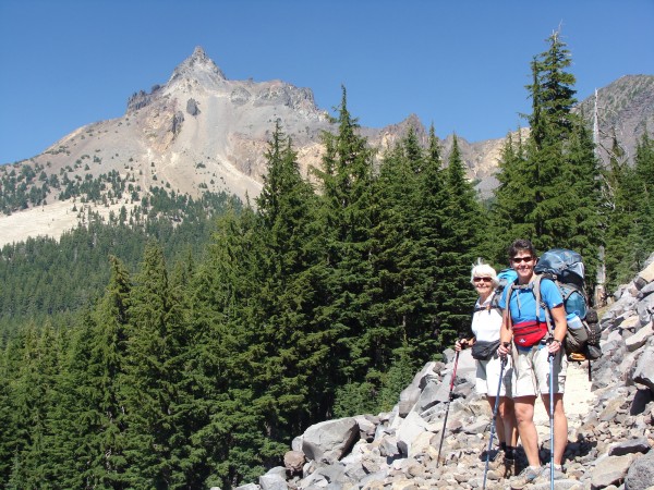
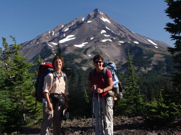
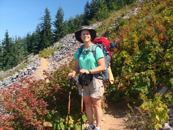
August 10th: Miles: 8.44 Thielson Spring
Arrived Crater Lake around lunchtime and had a bite to eat. Met a thru hiker who just finished hiking from the Mexico border. His trail name is 'too obtuse'. Ogled at the deep blue water and then my husband dropped us off at the trailhead of Hwy 138. Oh, we were so excited! Weather was perfect for hiking - blue skies and 70 degrees. Packs felt a bit heavy, but we'll eat our way through to the next resupply at Shelter Cove, several days away. Marvelous views of Diamond Lake and Mt. Thielson. Traveled 8.5 miles to Thielson Spring. Forget-me-not started getting cramps in her calves a half mile from our new campsite. She started drinking more water and that helped a lot. Found a nice site and set up the tents. Dinner was a lovely beef stew. It was actually pretty tasty! 
Met an interesting couple who have traveled the world and decided to do the PCT in its entirety. Had a nice visit discussing tomorrow's trail. Apparently they don't have maps and appreciated seeing ours.
Bedtime is calling - its almost 9pm! No critters sighted...
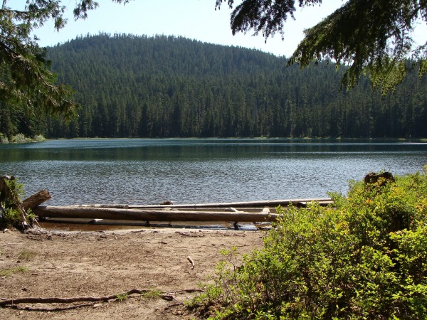
Aug 11th: Miles: 10.69 Maidu Lake
Although the night was comfortable with the temperature hovering around 50 degrees, none of us slept too well. Got going, broke camp, had breakfast, and visited with Sailor and Pasta Alfredo. Sailor was very interested in Hood River as she had to resupply five boxes once she reached Cascade Locks.
On the trail once more we meandered through beautiful forests and pumice rock. Reached the highest point of Oregon and Washington of the PCT at 7560. Trail was much easier today as most of it was downhill. Our goal was to reach Maidu Lake which we did in 10.69 miles. On one break, I was taking some pictures and a hummingbird landed on my trekking pole. Weather is still gorgeous although some high clouds are rolling in. We also smelled smoke, which we assumed was from the Williams Creek wildfire. No cell service here. Took the opportunity to wash clothes and bodies. Mosquitoes are very active here - I'd give it a 7 out of 10 for bothering us. I'm sitting here at the edge of the lake watching the sun set thinking it is time to run for the tent as the mosquitoes are becoming more bothersome. 

Vel and Karen are fighting some big blisters. I have lucked out so far and only have two little blisters on the end of two small toes. We may have to slow down tomorrow and keep an eye on the blisters. Our goal is Nip and Tuck lakes, approx 15 miles away.
Critters: tadpoles, mosquitoes, dragonflies, hummingbird, ants
Didn't write anything last night due to our almost 16 miler and being pretty tired last night.
August 13th: Miles: 15.73 Nip & Tuck
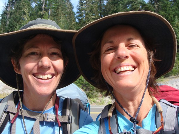
Left Maidu Lake around 8:15 and ran across two fellows who work for the forest service doing trail maintenance. One of them gave us PCT patches! We were tickled pink! We can't wait to sew them on our packs. (Hmm, I do have a sewing kit with me...) most of our walk was through forest with peeks of views. Met another Oregon section hiker but can't remember his trail name due to its weird pronounciation. These were the only people we met all day. After lunch at Tolo Camp, we had a long uphill trudge to a saddle. At the 10 mile mark we were starting to feel the effects of daily hiking with 5 more miles to go. Started noticing fairly fresh bear scat on the trail loaded with red berries. Karen whipped out her bear bell and jingled the rest of the way to the lakes. Karen now has a trail name name - Jingle Bell! I have been dubbed Gadget Girl due to carrying a smartphone, solar panel and camera. The solar panel has worked wonderfully for charging my phone. It's worth the extra weight.
The last 1.5 miles were pretty hard but we finally arrived at Nip & Tuck Lakes. We dropped our packs and hobbled into the water. Forget-me-not says, 'I don't want to alarm you girls, but there are bloodsuckers (leaches) in the water'. Looked down and saw them - shrieked and ran out of the water.

After that we cleaned up the best we could, made dinner, attended to blisters, and prepared for bed. Started to sprinkle and Forget-me-not and Jingle Bell ran out of the tents and put their pack covers on their packs. Finally settled down and fell asleep listening to the pitter patter of raindrops.
August 14th: Miles: 13.83 Diamond View Lake
Things I have learned:
Three liters of water is heavy.
Walking 14 miles in sand is very tiring.
Carrying a 40 pound pack is heavy.
A huge appreciation of national forest trail maintenance workers.
The last 1.5 miles is the hardest.
Leaving leach filled Nip & Tuck Lakes, we enjoyed a nine mile downhill to Crescent Lake. Ran into three older ladies on their horses and had a short visit with them. The PCT Handbook was very confusing in its directions to Crescent Lake, so we abandoned their directions and went cross country until we came out onto a road. Walk about 1/4 mile and found a day use area with a picnic table and an Outhouse! We were in seventh heaven. Took the opportunity to dry out the tents, charge the phone, bathe, and use the outhouse. Thank goodness as we had pretty much run out of T.P. You probably guessed it, we 'borrowed' a handful to get us to Shelters Cove. Back to the PCT Handbook, we meandered our way over to the horse camp and found Trail 42 that took us up to Diamond View Lake, 5.5 miles away, all uphill. Ugh. It turned into a 14 mile day. Overcast, windy, we rushed into our most cherished possession, our down sweaters. The lake was beautiful and we hoped to see the Diamond Peak mountain but it was covered with clouds. Bed again at 8:15pm.
You are probably wondering where the photos are - unfortunately cell service isn't strong enough to upload.
August 15th: Miles: Shelters Cove
No cell svc last night, will update when I can. We are starting the Three Sisters area with no cell svc, so may not post until we reached Sisters.
UPDATE (Aug 16th): Found cell service, so here we go... We had a lovely hike to Shelter's Cove, mostly downhill. It became a bit confusing getting down to the lake as the Pct Handbook wanted to direct us to the next section. We found the railroad tracks, crossed to the dirt road and down to the asphalt road. We knew Shelters Cove was somewhere close by so we started hiking east. Boy oh boy, our feet did not like the hard pavement, especially for blistered feet. Arriving at Shelters Cove, we collapsed on the grass. They had a grocery store where one could buy some packaged foods and hotdogs. Gadget Girl went straight for the biggest bratwurst and a cold Black Butte Porter.
Our supply guys arrived at 2pm and Bob thoughtfully brought fresh fruit and Twizzlers for the girls. Thank you Bob! Decision was made that it would be awesome to have a hotel room and clean up. Found a great hotel, the Willamette Inn, beautiful rooms. Ate dinner at the Crescent Lake Lodge - slow service but good food. Back at the hotel we resupplied our packs and then crashed for the night.
Sorry, no photos yet...
Oh, Forget-me-not is off the trail now. We now have Bob with us....
Still having an awesome time!
August 16th: Miles: 8.55 Brahma Lake
I love hiking. Something about being outdoors in the woods communing with nature nurtures my soul. Being here on the trail day after day away from the humming of the refrigerator, the high pitches of electronic devices, the noise of the TV, the rumble of cars and airplanes, is such a joy to my ears. Silence is golden, and my ears are loving the break of hectic everyday life. I lay in bed at night listening to nothing just for the sheer joy of silence.
We did a short day today of 8.55 miles. Jingle Bell and Tree Man (Bob) wanted to rest their feet. We started late and hiked to Irish Lake, 5.79 miles, and took a leisurely lunch. Over three miles of it was through a burned area. It was facinating seeing the dead silver trees with all the tops broken off. Very dramatic. We could see Mt. Bachelor and South Sister in the distance. Continued on to Brahma Lake. Oh, so beautiful. We have really lucked out with the weather so far. Another southbound section hiker stopped and set up camp with us and her trail name is One Step. Jingle Bell and I loved talking with her. She is 61 years old and is very involved with trail maintenance in Washington State.
Cell service comes and goes - I feel lucky to be able to send text messages to my husband and son. It's much harder to get an email out, like this journal entry.
Thank you for all the Guestbook entries! We love them - keep them coming! Some of them are hilarious! Only thing, it is easier for us to know who they are from if you would add your first name to your entry.
This tune, sung to the tune of Jingle Bells, is dedicated to Forget-me-not:
Walking down the trail
With our backpacks on our backs
Through mountain, fields and streams
Enjoying everything,
Friends will come and go
Vel we miss you so
What fun it is to hike this trail
On the PCT we go.
Oh, our packs are big
Our feet are sore
What were we thinking of
But the view we see
Are worth everything
On the PCT we go...
(by Jingle Bell)
Love,
Gadget Girl and Jingle Bell
August 17th: Miles: 13.66 Dumbbell Lake
Woke up to 40 degree temps and quickly ate breakfast and packed up. Visited with One Step one last time and then hit the trail. We had visions of making Elk Lake by dark, but after 13.66 miles, our feet were pretty tired and getting sore. Elk Lake was another 8-10 miles past Dumbbell Lake. I think this lake is our favorite so far. It is shaped like a dumbbell and we camped a little higher than at the water's edge. The sun felt quite warm until it set. Some young guys wandered in looking for a place to camp (we had already retired for the night - 8pm) and they were carrying a rifle. Sure made us nervous. They definitely were not thru hikers. Thank goodness they didn't set up camp right next to us, but we could hear them thru the woods. One thing about these lakes on the PCT, there aren't very many campsites at each lake. One, maybe two at the most.
By the way Chris, we are using our Handy Hanky's and they are getting a workout wiping our foreheads and sunglasses. That's right folks, the Handy Hanky, a simple cloth attached to an retractabe cord that attaches to your shorts or pack and is available for wiping that sweat right off of your brow in an instant! Want one? Just let me know and I'll pass your info to the inventor.
No cell svc at this lake but I'm hoping we will have something at Elk Lake. We are excited to stop in at Elk Lake as Jingle Bell and I appear to have run out of lunch material. Peanut butter and tortillas is getting old already.
That's it for now, it's 8:20 and time for bed...
August 18th: Miles: 13.75 Sister Mirror Lake
Well, we didn't get shot at last night. The guys with the rifle were pretty quiet, thank goodness. And no, Hershel, we still don't need your pistol, but thanks for offering it!
We broked camp early and headed to Elk Lake and real food for lunch. It wasn't part of the original agenda, but that's okay. One thing you learn out here is how to be flexible and go with the flow. The distance to Elk Lake was shorter than I thought - just over 6 miles. Had a leisurely lunch of cheeseburgers - very good! Spent for an waffle ice cream cone to finish off the meal. Decided to buy a sandwich for tomorrow's lunch as my peanut butter and tortillas supply is getting quite low. Didn't plan so well for lunches.
We keep meeting such interesting people from all around the world who are thru hiking. Oh, we also meet section hikers and we swap stories giving each other a heads up on what's coming up or a news tip from the PCT grapevine. People are quite interested about PCT hikers and ask dozens of questions.
After lunch we headed back to the trail and headed up, up, up, to Sisters Mirror Lake. Temperature was 85 degrees and Jingle Bell and I were trying to make the best of it with baby steps and taking frequent breaks. At one point we had to come to a complete stop and take a siesta. On and up we went and finally made it to the top with views of Mt. Bachelor, Broken Top, South Sister, and Middle Sister. Had a lovely downhill to the lake but found it pretty crowded with overnighters and other backpackers. Made camp in a small spot and squeezed in three tents. Jingle Bell was too tired to eat and she had to attend to new blisters on her feet. Poor girl. I was hungry so I cheated and ate half of tomorrow's lunch. Mosquitoes are ferocious here. I'd give it a 9 out of 10. Found cell service down at the lake - didn't expect it and I'll try to get this sent tomorrow.
Looking forward to tomorrow's hike as we meander thru the Sisters, The Wife, and The Husband. I hope it won't be as hot as it is today.
August 19th: Miles: 13.19 Obsidian Falls
Had to fight the mosquitoes to get packed up this morning. We also woke up to a heavy dew and my tent was completely soaked with condensation inside. It was actually dripping on me, my sleeping bag, Thermarest, and everything else I had inside. Whew, what a mess. Packed up everything wet and headed out. It was quite warm even before 8am and continued to heat up as the day moved forward. Treeman says, 'oh, it's flat as a pancake for the first five miles'. Yea right, which part of the first 500 vertical gain shall we call flat? 
I was so looking forward to this part of our adventure as I had heard so much about the Three Sisters and Obsidian Falls. I was not disappointed! Gorgeous views of mountains, volcanic rock, wildflowers, glacier fed streams, and super friendly hikers everywhere. We met Socks and E-Blanket who are thru hiking. They were fun to talk to. We made the mistake of not filling up our water supply and Jingle Bells ran out of water a few miles from Obsidian Falls. It's a drag to be out of water at 6,500 feet and have dried up creeks everywhere. But the wildflowers were pretty!
Arrived at Obsidian Falls and made camp with two other hikers (they didn't know each other). Had a nice visit, cleaned up our stinky, dirty bodies and hit the sack.
Too tired to write more - will try to do an update when we take our zero day on Friday. Our resupply gang is showing up tomorrow evening. Yay! Clean clothes, real food, and a shower!
August 20th: Miles: 11.22 Lava Camp Lake
We really enjoyed the Obsidian area - so beautiful. We had to hike over a pass of lava rock, steep and switchbacks galore. Treeman was really bummed as his camera ate thru two sets of batteries in nothing flat, so he only got a handful of photos. We ate lunch with Peanut Eater, a friendly Englishman who resides in Los Angeles and hasn't lost his accent. (Cheerio, Peanut Eater!)
After traveling thru gorgeous scenery, we had a hill climb that I wouldn't even do on my dirtbike. It was way more than 15 degrees ascent. It was hot and the only thing that saved us was the breeze. I was anxious to get to Lava Camp Lake as my husband, son, Forget-me-not and her husband were going to pick us up and take us into Bend where my husband parked our 5th wheel in an RV park. We arrived at the lake around 4pm and had to wait a couple of hours for our pickup. No worries, Oakie Girl was there with trail magic: pop, beer, wine, water, snacks, sandwiches, etc, and she was busy running hikers to and from Sisters. Peanut Eater was also there partaking in the spread. Hamster showed up and caught a ride to Sisters from Oakie Girl. Finally our gang arrived and after introducing people back and forth, we loaded up the truck and went to Sisters for dinner. It was something like Three Rivers Restaurant. Very good food!
We finally arrived exhausted at the 5th wheel and the dirty three went and took showers. Treeman set up his tent and initially started out there, but the road noise was so bad, he ended up in the 5th wheel.
I haven't been taking a lot of photos with my cellphone, the cell service has been touch and go throughout our trip.
August 21st: Miles: Zero Day in Bend
Zero day! Spent the day visiting with family and friends and then made a run to Walmart (darn, no NIDO here) and to REI. Jingle Bell needed new socks and Super Feet for her shoes. I really wanted a long handled spoon for the freezer bag cooking. Short spoons don't work, I found out. Also did some school clothes shopping for my son. Went to out to dinner at Boston's which had pizza on the menu, among other yummy things.
Spent the rest of our time resupplying our packs. Treeman went home with Forget-me-not and Bud. Checked the weather forecast and the outlook looks the same, dry, clear, and maybe a little cooler. Also was able to upload a handful of photos. Didn't get a lot done as the wireless kept dropping and my husband didn't bring my mouse with my laptop and I had to resize all my images as they were too large for Postholer's size restriction. Anyway, I will post the rest when I return home.
August 22nd: Miles: 13.69 Big Lake Youth Camp
We had our latest start yet. Didn't help that we were 20 miles from the trailhead. Said goodbye to my family and started hiking at 10am starting at Lava Camp Lake. Sheesh, it would have been nice to know that we could have skipped 2 miles of lava walking if we had driven bast the Lava Camp Lake road. Partway thru, we decided to take off our leggings and apply sunscreen on our legs. I took off the cap off the sunscreen tube and it promptly flipped out of my fingers and rattled down between the lava flow. There went that cap. Grabbed some duct tape off my pencil and taped the tube down. First crisis of the day over with. Continued climbing the lava flow for about 4 miles with an 800 ft elevation gain. Doesn't sound bad until you add a newly loaded backpack filled with resupplies, AND this time with a bota bag full of wine, AND some fantastic rum cake our friend Eileen from Utah made. Then we ran into a huge burn - miles of it. Depressing stuff. Up, up we continued to climb. Around 2pm I started to sag with the heat, dust, and finding myself terribly missing my husband and son. Jingle Girl gave me a pep talk and volunteered to carry the wine the rest of the way. Finally found ourselves on the back side of Mt Washington and started taking pictures again. Jingle Bell started swearing and I turned around to find that she had dropped her camera face down (with the lens out) in the thick dust/dirt. We did the best we could to clean the lens and surrounding movable parts, but the lens wouldn't close all the way at first, and then when we got it to close finally, it threw an error that the lens wasn't operating properly. So there goes that camera. Jingle Bell was soooo bummed, especially since she had been so careful with it since the beginning.
Then we started the miles long downhill to Big Lake. We were planning on having dinner with the Big Lake Youth Camp group. It took awhile to figure out where the camp was as we had to leave the PCT trail and mosey down a parallel trail. Finally found their welcome sign, found the office, bought a meal ticket for 5.00, found a bathroom, took a shower, washed our filthy socks, and joined the rest of the camp for dinner. They only serve vegetarian. It was great. Loved all the fresh vegetables and fruit. The office pointed us in the right direction for setting up camp afterwards. Just have to say that after all these days on the trail, today was the dirtiest. We even had to clean the exterior of the shower stalls as we were filthy. The people here at the camp are very friendly and asked lots of questions of our big adventure.
Well, that's about it in a nutshell. Although we only went 13.69 miles., we are exhausted from the elevation gains and hiking in the sun.
August 23rd: Miles: 14 South Dixie Lake
Time is flying by. Can't believe its already the 23rd of August. We started off from Big Lake Youth Camp area around 9am (another late start, oh well) and had almost a 'flat as a pancake' 5 miles. Ran into trail magic on both sides of the freeway (20) and enjoyed a cookie on the south side and a hard boiled egg on the north side. Jingle Bell enjoyed the carrots and zucchini muffin. Charged forward with full batteries and continued up the PCT until the intersection where we would take the alternate route north. Since we can't do the 17 - 20 miles at a time and avoid the dry sections without water, we prefer to do some of alternate routes that have a lake every few miles. We hiked thru another burn area (sheesh, there are a lot of them), about 3 miles of it, and then finally arrived at lovely green forest. We stopped at Lower Berley Lake for lunch around 1:30. We took an hour lunch break and enjoyed our first 'high tea' with rum cake. (Except I had coffee.) Finished off the fantastic rum cake and slowly packed our packs and headed north. At this point we only had 9 miles under our belt. It was obvious that this was an extremely popular place to hike in and camp as the trail at one point was like a freeway. Very wide. The trail itself was the usual very fine sandy soil that makes the legs extremely dirty. We even left our leggings on and our legs and feet were still covered in dirt.
Continued on and after a 200 elevation gain, we landed at South Dixie Lake. Wasn't sure about the camping conditions so we hiked on to North Dixie Lake. Found that it had inadequate camping conditions so we returned to the south lake and made camp. Had a great linguine with mushrooms and white beans for dinner; Jingle Bell had beef stroganoff. We also drank part of our wine that we hauled up with us. And we had dessert! A chocolate strawberry crunch. It was great.
It is quite chilly this evening and we have already retired to bed. We can hear the camp robbers outside poking around the area that we cooked dinner. Good luck camp robbers, there is nothing left for you...
August 24th: Miles: 13.5 Papoose Lake
Whew, what a day. We were both chilly during the night and woke up to 39 degrees. Brrr... Jingle Bell's socks were frozen.
We both agreed that this day was the worst one so far. We walked in burned up forest most of the day. The PCT handbook had recommended to go this way, but now from personal experience, we would urge all PCT hikers to avoid this alternate route. We felt like we were in a jungle part of the time and had difficulty following the trail. The burned section (which was most of the trail) was ugly. Don't go this route! Thank goodness for GPS...
We ended up at Marion Lake for lunch and to refill our water supply. I startled a deer and almost peed my pants as it went leaping uphill away from us. We found an ice cold creek to filter our water and it tasted tons better than the water we drank in Bend.
As we were leaving Marion Lake, we had a steep uphill to negotiate. Jingle Bell was in the lead as she is faster at hills than I am. I arrived at the top and Jingle Bell was nowhere to be seen. Huh. The trail split and I hustled up the right trail (which was the correct trail) to catch up with her. A mile in and no sign on Jingle Bell. By this time I had been yelling her name hoping that she would stop. Then I realized that she wasn't in front of me and she must have taken the other trail. I dropped my pack and started back toward the trailhead yelling and whistling all the way. Finally I heard Jingle Bell yelling my name. She was a little panicky over being by herself. But we were back together again and proceeded toward our goal of Papoose Lake. Took forever, up and down, walking in burned forest. We were starting to get really tired and finally came across the lake. Dropped the packs, set up camp, cleaned our filthy bodies, made dinner, and went to bed.
It felt like 20 miles but it was only a little over 13 miles...
August 25th: Miles: 15.15 Scout Lake
Woke up to brisk temperatures (39 degrees) at 6am. Did the usual routine and headed up the trail. We decided not to continue the alternate route and to divert over to the PCT. Had a nice switchback hillclimb over the saddle to the next valley. Meandered along the ridge until we came to THE trail. So happy to be back on it! Had a lovely hike to Shale Lake where we decided to dry out my tent and sleeping bag, plus charge my cell phone. Ate lunch, packed up and spent the next couple hours (6.5 miles) on a great downhill. Of course, what goes down must come up and we had to hike over 5 miles uphill. Came to the dreaded Russell Creek and looked for the cairn that marked the best place to cross. Jingle Bell was a little nervous about the crossing, but we did just fine. Didn't even get our shoes wet. It was pretty dang scary jumping rock to rock with a heavy pack on and watching the milky water rush below you. We then had some more uphill to get to Jefferson Park. Ah, gorgeous views of Mt. Jefferson and meandering streams through green valleys. Wildflowers are out but we were too tired to enjoy them. Ran into a day hiker and asked him if heard a weather forecast. Sounds like clouds and cooler air are on their way. 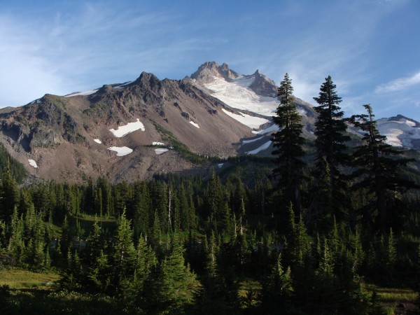
Found a good campsite at Scout Lake. As we were preparing for bed, Jingle Bell realized that she didn't have her night light and must have left it 15 miles back at Papoose Lake. Boy, was she bummed.
That's it for now. We meet up with my husband Dave tomorrow for a resupply and to drive us up to Timothy Lake. Since we are on a time crunch, we decided to forego the Warm Springs Indian Reservation and restart at Timothy Lake.
August 26th: Miles: 16 Timothy Lake
Halleluia! Jingle Bell found her head lamp! It was in her tent bag of all places. She was one happy camper!
Had a lot of wind last night. Temperature was about 40 degrees but felt warmer. Mt. Jefferson was out in all its glory - blue skies and not a cloud anywhere. Fabulous day for hiking. Did a quick wash of socks and undies, packed up and headed north. Yikes, we had to tackle a huge ridge with a 5.4 difficulty (very long and steep). The views of the mountain and Jefferson Park were astounding. No wonder its such a popular place to hike to. We met some thru hikers, Crusher, Shane, Root Canal, and Mowglie. They were fun to talk to. Most of these young hikers are unemployed and are just out enjoying setting goals hoping the economy will turn around soon. We stopped at Breitenbush Lake for lunch and to soak our feet. We quickly found out that the lake was part of the Indian Reservation and we weren't allowed to go into the water, not even to soak our feet. The people holding ground pointed us over to a pond where we could sit and soak our feet. There was also a pipe with cold, fresh water that we could fill our water supply with. It tasted wonderful!
By this time we had only put in a little over 6 miles and we had to push to put in another 8 miles to meet up with my husband at 4pm for a resupply at Ollalie Lake. We hustled and arrived at 4:15. Dave had New York Sub Shop sandwiches for us for dinner. And pop and beer! Yum, yum!
Meanwhile, while we were zipping down the trail to meet Dave, he met the group named above plus one other fellow who wanted catch a ride to Timothy Lake with us. Didn't catch his name. So we drove to Timothy Lake, did our resupply, and did another 1.5 miles to Meditation Point where we made camp.
August 27th: Miles: 13 Twin Lakes
Had some interesting noises last night. Sounded like something big entered our campsite, played in the water, and then upchucked on the broken down dock. Neither one of us were willing to leave our tents to see what was going on. It was a pretty warm night in comparison to some of the chilly mornings we have had. We wanted to get an earlier start so we had our coffee/mocha and munched on some cherry poptarts. May not have been the healthiest choice but it was tasty!
It was a 3 mile jaunt to the intersection of the PCT, and as we approached it, we heard a noise in the tall bushes. Stopped to check it out as we had just spotted a young deer dashing through the woods a little bit ago. Well, here was a BIG black face staring at us. I whipped out my camera and took some pics. It was big, black, had the cutest face and was wearing a cow bell. Yep, that's right folks, the closest we have come to a bear and it turned out to be a cow. So we named it 'Big Bear'. 
Jumped on the PCT and headed to Twin Lakes, 10 miles away. We had an unexpected long uphill grind in the heat before it turned downhill to Hwy 26. Crossed the Hwy and found a sno-park to rest our laurels. We only had 2 miles to go but I was starving. Those poptarts don't have the lasting power of our other breakfast foods. A family drove up and asked if this was the trailhead to Twin Lakes. Yup, we said. The dad was thrilled and danced his way back to his carload of four kids and wife and started unloading. Jingle Bell and I looked at each other and quickly put our lunch stuff away, put our socks and shoes back on, hoisted the packs to our backs and headed to the trail. We arrived at the first lake and dropped our packs in the first site we saw. Set up camp, cleaned up our filthy bods, and were doing minor chores when the family rolled in. The dad took off his pack, asked a few questions (we also warned them about the masses of bees in the area) and asked me for help to get his pack back on. I swear to you, this guy was hauling 125 lbs on his back. It was hugely heavy. First time backpacking with the kids and they brought everything, including full size camp chairs. I think the dad was carrying 95 percent of the equipment. Amazing. Of course we had to ask to take his picture!
Twin Lakes is actually two lakes and we camped at the lower one. We could tell how heavily used this campground is. We wouldn't want to be here on a weekend, let me tell you.
I just wanted to give a huge THANK YOU to my husband for being a trail angel and a resupply guy rolled into one. He has done an outstanding job of supporting us. Now his roll is complete and Jingle Bell's husband will finish with our last resupply tomorrow.
Tomorrow we have a 9 mile hill grind to Timberline Lodge. Then we get to stay overnight there, have a hot shower/tubby, eat real, fresh food, wow! Thank you John, husband of Jingle Bell!
While I'm in the thank you mode, I also want to thank Forget-me-not, her husband Bud, and Treeman for also supporting us and doing the Shelters Cove resupply.
We only have 5 more days of our Big Adventure - we can't believe how fast the days have rolled by (but our aching feet can)!
August 28th: Miles: 9.52 Timberline Lodge
Tough night last night listening to the two guys and girl screaming out loud and playing music until all hours of the night (drugs? alcohol?). I used my ear plugs to tune them out but Jingle Bell had to listen to them for hours. It was also a warm night so ended up kicking the sleeping bag off a few times.
As we were packing up, the dad of the four kids came over to see if we had a surplus of hot chocolate for his kids. It was the one item they forgot and the kids were most looking forward to. Alas, Jingle Bell had just used her last packet. On that note we headed for the trail back to the PCT. 
The first 7 miles were an easy up and down enjoyable hike. The last 2 miles or so wasn't as fun. We arrived at Hwy 35 thrilled to be at Barlow Pass. Took the required photo and zipped across the highway. Resumed hiking and soon we could hear music playing. It was like at a rock concert. Puzzled, we continued on thinking that there must be a party at the campground just below the Lodge. We arrived at the treeline where the wind had picked up big time and was swirling the sand everywhere. Whew, hiking steep hills in deep sand with sand smacking your face is not very fun. It seemed to take forever to get to Timberline Lodge. We could see van loads of people and white tents set up so now we knew something was going on. Found out that it was the Hood to Coast race and they were sending out teams every 30 minutes. Since we were so smelly and dirty from our big hillclimb, we hit the public bathroom and did the best we could in cleaning up. Lunch was calling our name (we were pretty sick of peanut butter and tortillas by now) so we found the Blue Ox and had a great lunch. Watched a thru hiker go thru the brunch buffet line three times with heaping plates. My, he must have been hungry!
The afternoon was passing quickly so we checked at the front desk to see if our room was ready. Yep, it was, so we had a proper cleanup with hot water (shower), had a short nap, and waited for Jingle Bell's family to show up with our supply boxes. They arrived right on time; we quickly did a resupply and then all of us went to dinner. Great food!
Heard a forecast that some weather was creeping in so we were glad to be the Lodge tonight!
August 29th: Miles: 10.14 Ramona Falls
You would think that staying overnight at the fabulous Timberline Lodge that we would have a great night sleep. Well, well well. It may be big, expensive, and have cool things inside, but you can still hear people snoring in the rooms around you. It was also hot in the room. I took off the down feather top thingy from the bed, removed the heavy wool blanket, and kicked off the rest of the bedding just to try to get cooled down. We are so used to sleeping in the open air, it was tough to switch to a closed in room. We attempted to open the window but didn't realize there was a stick we had to use to prop it open. Old windows, old building... Oh well...
My guys arrived with Forget-me-not and Bud to have breakfast with us. Yep, more food! The breakfast buffet was delicious - loved their scrambled eggs with spinach, cheese covered potatoes, sausage and bacon, among other items. Jingle Bell and I were determined to hit the trail by 9am and we only missed our goal by 20 minutes. Hugs and kisses all around and then we hit the PCT northbound heading for the low clouds filled with 20% moisture. We only got about .7 miles away when we had to get our pack covers out and cover our packs. Continuing on, we enjoyed beautiful wildflowers thru the low clouds with heavy mist (fog). We didn't do the Paradise Loop portion as we figured we would come back soon when the weather was better. Enjoyed a long downhill, even a long uphill, before the final 3.5 mile downhill to the Sandy River. A couple of times we weren't sure which way the PCT trail went as the signage was not obvious, but we figured it out with our map and gps. We did run into three people who just finished the Paradise Loop piece and they pointed us in the right direction at one point. 
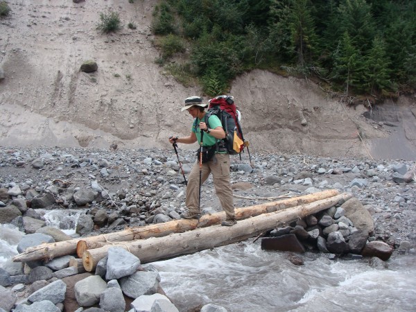
Arriving at the Sandy River, we scouted around looking for best place to cross. Jingle Bell found THE place to cross about 100 feet upriver by a pink flag. Someone had lashed together three logs and placed them over the river. Jingle Bell went over quickly before she could think about it. (the things you find out about your friends while long distance hiking. I didn't know she disliked river crossings.) Crossing rivers, either on logs or hopping rocks has never bothered me and I even went over again so she could take some photos with my camera (remember: Jingle Bell's camera bit the dust).
Continued on and found a campsite near Ramona Falls. We thought we might try for another 5 miles, but it was getting late in the afternoon and a passerby backpacker said there wasn't anywhere to pull over and camp until Lolo Pass. So we are spending the night right here at Ramona Falls. As we finished setting up our tents (and had a lovely cup of afternoon coffee), it started to seriously rain. Snuggled in our tents we are waiting for a break in the weather before we make dinner.
I have been curious how my Tarptent handles the rain, and so far, so good...
August 30th: Miles: 11.32 Salvation Springs
You may be wondering why our mileage has lowered a bit. From Timberline Lodge to Eagle Creek TH (trailhead) there are only so many campsites and water sources to be found. Since we can't do more than 13 to 15 miles per day, we make do with the 10 to 12 miles each day to reach each destination successfully. We have found that we are stronger since we started, but can't quite make 20 miles at a time. We usually start hiking around 8:15 and finish around 3pm. We could hike more, but usually the next destination mileage wise is out of our reach.
We left Ramona Falls with 50 degree temps, oohed and aahed over the Falls, and quickly descended to the PCT cutover. Just before the very long and steep uphill, we enjoyed walking over a rushing creek on a huge horizontal tree with a handrail attached. Halfway across, the tree started bouncing. Pretty cool! Then it was up, up, up to Bald Mtn where we ran into three day hikers who were looking for McNeil Point. Luckily they had a hiking book with map since we didn't know where that was. On we went to Lolo Pass where we stopped to have lunch and dry out tents and my sleeping bag. It wasn't wet per se, just damp from the overnight showers. It was interesting to see the ATV and dirtbikers arrive and depart to parts unknown. They must ride the dirt roads under the transmission lines.
After lunch we started a moderate climb paralleling the Bull Run Watershed. I kept expecting to see a bear 'cause that is where they like to hang out, but we only saw some day hikers and four horses (and a dog). We haven't seen any thru hikers for a few days. Maybe they hitched to Cascade Locks for the big PCT Festival yesterday. They were all talking about it.
We arrived at Salvation Springs, set up camp, filtered water, made dinner, and were ready for bed by 6:30pm. Sheesh, are we boring or what?
August 31st: Miles: 23 Eagle Creek and Home
Amazing! We did it! We hiked 23 miles in one day! Boy, our feet are sore...
There's something about the last two days that makes your mind switch to home and things that need to be done. Jingle Bell and I were talking about the final push to Eagle Creek and decided, what the heck, let's see if we can do a 20 mile day. Once the thought was cemented in our brains, our legs took off like a shot towards Eagle Creek. Walking the ridge we could see Lost Lake below us and a lot of smoke filled valleys. Not sure where the smoke was coming from but it made for variations of blue against the sky, Mt Hood, and the mountains. Thru hiker Willy Nelson zipped passed us practically at a gallop. Boy, could he walk fast. Just prior to Indian Springs Campground, we ate lunch on top of the hill with a beautiful view of the surrounding area. We have to get Forget-Me-Not up here. She would love it. There was a stone sitting area that would be perfect protection from the wind that someone built. Headed down towards Indian Springs Campground and surprised to see a car and Willy Nelson having a beer and getting some stir-fried grub from friends. He offered us a beer but we declined as we were on a mission to put the miles under our feet.

Continued on the trail until we realized that we missed the turn off for the shortcut down to Eagle Creek. Verified it with the GPS and then headed back to the group of people who pointed us in the right direction. Yikes, I don't know if we would have found the trail, the signs are clearly gone. Anyway, down the trail we went. All the hearsay about this trail is true. It is rough, steep, and not any fun. By the time we arrived at the end of this trail, it was 2:15pm, our knees were complaining and we were sweating like pigs. And we still had about 8.5 miles to go. Thank goodness it was mostly downhill. Since we have hiked Eagle Creek many times, we simply went through the motions of hiking and taking the appropriate photos. One thing was interesting, we have never been in Eagle Creek at this time of the day so it was great to see the different waterfalls, especially Tunnel Falls, under the late afternoon sun. Willy Nelson caught up and passed us at Tunnel Falls. We were also surprised to see how many people were hiking in at such a late time, especially the ones who weren't outfitted properly.
Success! We arrived at the trailhead at 6:10pm! We cheered and hugged, called our husbands, and then hiked to the bathroom!!!